Wednesday, September 28, 2011

Dedicated street space for transit (and bikes) - the key to creating a sustainable transportation network in Baltimore

For the past several weeks, we've been focusing on the elements needed to make transit popular and widely embraced in Baltimore. Here, we tackle the one that is perhaps the most challenging to achieve, yet could pay the greatest dividends in transforming Baltimore: creating dedicated rights of way for transit service on our streets. That's ok - like the saying goes, "The hardest things in life are the ones most worth doing."


The difficulty in achieving this has less to do with the technical challenges or even the cost, and mostly about the political will to do it. Carving out street space for transit vehicles to create dedicated bus lanes - which can also serve a great dual purpose as bike lanes - is relatively easy to do from a technical standpoint. It typically requires converting a travel lane in each direction for exclusive use of transit vehicles, which can include buses, streetcars, or light rail vehicles.
Dedicated bus lane in New York City (NYCDOT)
The cost associated with basic conversions as a first step would include the cost of paint for lane re-striping and pavement markings, new signage, and signal modifications. In later stages, more advanced transformations can occur, which can include partial or full street construction with new curb lines and hardscaping, transit priority signal systems, barrier-free ticket vending, and other associated infrastructure improvements.  The latter is often to referred to as "bus rapid transit" or BRT, although I hesitate to use that term because there are often biases or perceptions about BRT that frequently pit BRT against rail. Whatever name is used, this is about making incremental changes over time that can greatly enhance mobility in highly effective ways.


While these kind of changes do cost money, the cost of gradually introducing dedicated transit lanes along select corridors in the coming decade is a drop in the bucket compared to the astonishing cost of expanding highway lanes in our region. As Carol Sildorff, Executive Director of Bike Maryland, succinctly put it in a recent interview, "(Portland, Oregon) has spent 52 million dollars to build a multi-modal system of transport, when it costs the state $60 million to build a mile of highway." There's also a growing realization that the benefits of expanding highway lanes are dubious at best, as increased lane capacity only induces more driving, cancelling out the temporary reduction in traffic congestion within a relatively short period of time.


So, it's really not about the cost alone, it's about recognizing the benefits versus the costs to realize those benefits. Leaders in our region first need to understand the benefits of creating multi-modal transit corridors. The benefits, especially if they are designed to be part of a seamless network, rather than independent routes, would be substantial. Multi-modal transit corridors can act as a powerful revitalization tool that can catalyze re-investment, redevelopment, and affordable housing opportunities along the corridor, expand sustainable mobility options and decrease reliance on cars, while reducing the region's carbon footprint, improve air quality, and enhance quality of life for residents. 


It's a big idea that won't happen overnight, but it can be implemented relatively quickly once the will to do it exists. The concept really needs to start within the dense urban core as a pilot and expand outward, and/or along a select number of heavily used transit routes. In fact, dedicated transit lanes have already been introduced recently in Baltimore City, along Pratt and Lombard Streets, where a bus-and-bike only lane was implemented in early 2010 in conjunction with the Charm City Circulator. However, the City needs to do more to make these lanes clearer to drivers and to provide greater enforcement to keep cars out of them. 
The Pratt Street bus-bike lane
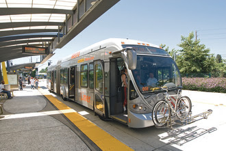
A natural place to start creating multi-modal transit corridors is along the MTA QuickBus routes. These routes have been gradually implemented over the past four years to provide premium bus service that attempts to emulate light rail in terms of frequency and stop spacing. Creating dedicated lanes along QuickBus routes, at least initially within the city limits, and upgrading the bus stops with better facilities, branding, customer information, and better marketing of the routes as part of a "metro rapid network" could be a game changer in how transit is perceived.
An MTA Quickbus


There's little doubt that MTA would be happy to implement these kind of enhancements if they were given the resources to do so. The key is in getting regional and state leadership to recognize the benefits and re-prioritize the funding pie over other transportation projects that only perpetuate the vicious cycle of temporary "congestion relief." It's also time to press the case for making our streets more complete by carving out space for transit vehicles and bicycles where it makes sense.


Here are a few examples of efforts in this regard happening around the country and the globe, from which Baltimore can learn:


In 2009, Boston Mayor Thomas Menino announced, "The car is no longer the king in Boston," and began an unprecedented effort to redesign how Boston's streets function for all modes of transportation - including dedicated transit lanes. This is the kind of leadership and vision required in order for change to occur.


In New York City, the MTA and Department of Transportation have started introducing bus rapid transit service on dedicated bus lanes called Select Bus.

NYC SelectBus Service


In Paris, the Mobilien, was started in 2007 as a bus rapid transit system, which added new combined bus, bike, and taxi only lanes.


Several views of the Mobilien
In Los Angeles, the Metro Orange Line began in 2005 as a true Bus Rapid Transit Line. This is a good example of a high end BRT line, but even the substantial cost (approximately $325M for the 14 mile line) represents a fraction of the cost of roadway widening, and provides far greater benefits.
LA's Orange Line
Even Jacksonville, Florida, not known for its dedication to creating transit-friendly environments, has recently announced plans to create a network of dedicated bus rapid transit lines. 


Next time, we'll be discussing the need for good customer information systems.

Wednesday, September 21, 2011

"Transit 2.0" - Effective Marketing and Branding in Laying the Groundwork for a Popular Transit System

Los Angeles Metro's new marketing campaign (source: EMBARQ)
As we continue our series on what it will take to create a popular transit system in Baltimore, we turn our attention to the 2nd of five elements: Effective Marketing and Branding.

To be sure, marketing is only as good as the product or service being offered, whether it's pasta sauce, financial planning, or transit service. For the sake of this discussion, though, let's set aside any current shortcomings of Baltimore's transit system and assume for the moment that it is as good as anyone would want or expect in terms of convenience, on-time performance, cleanliness, safety, etc.

Instead, we'll focus on how a transit system is perceived by the general public and consider the following litmus test for Greater Baltimore:

  • What is the overall image of the transit system? Are the various transit modes - the buses and trains, the stops and stations, waiting areas, signage, logos, and customer information media - designed to have a consistent, seamless, and attractive look and feel? Is it immediately recognizable and possess a strong, positive identity that acknowledges the uniqueness of the region it serves?
  • How "user-friendly" is the system? That is, how is information about the availability of transit service disseminated and how easy is it for potential transit patrons to use the system and navigate from Point A to B? Is it clear, legible, and easy to comprehend? To what extent are the transit services associated with places and destinations to which people want to go to? How well are the services designed to attract and serve various market segments, trip purposes, and distances?
  • And finally, to what extent does it appeal to a wide audience? How broad or narrow is the market? Who is the audience - both existing and potential - to which the service is being marketed? In the post-war period of the last fifty plus years, during which owning and operating private vehicles became the de facto mode of travel for the vast majority of American households, the unspoken mission of most transit systems in the U.S. has been relegated to serving two, very limited markets: 1) "Transit Dependents" - modest income and disabled populations who are unable to drive; and 2) Middle-class suburban commuters who work in the central business districts (often called "choice" or "discretionary" riders by transit planners). Unfortunately, these combined markets constitute a very small fraction of total trips made by individuals each day in most metro areas, including Baltimore. The result is that transit systems have been a reflection of these limited markets to which they serve, rendering transit of little use to those who don't fall within one of those two categories. Similarly, the marketing and branding of transit has largely been a reflection of these limited markets, and the ability and availability of resources to craft an appealing transit image to a broader audience has also been severely restricted.
So, to these points, transit agencies have been missing a third and very important potential market: the growing numbers of Americans of all classes and ages who want or need to live, work, and play in more sustainable communities where they are less dependent on driving. The U.S. is undergoing an unprecedented demographic shift in terms of household composition and lifestyle preferences. Americans increasingly want to live where they can take advantage of convenient transit, biking, and walking as travel choices. These include young professionals, who are increasingly seeking out places to live and work based on the availability of good transit service and amenities within walking distance. Many of them can afford to own cars - and often do - but want greater options and less reliance on cars. An increasing number of them can't, as the continued global economic meltdown is making it more difficult for a growing number of Americans, especially recent college graduates who can't find professional jobs, to afford the $8000-$10,000 per year it costs to own and operate a car.

Baltimore has a rapidly growing population of creative class residents - many who have relocated from elsewhere to take advantage of proximity to employment and cultural opportunities, relatively affordable housing, and Baltimore's gritty, urban charm. Baltimore also has a high concentration of institutions and destinations which see millions of visitors each year from people who come from outside of Baltimore. Few of these are marketed as transit-oriented.

In addition, there are also untold numbers of working families, empty nesters, divorcees, retirees, and others who would consider relocating to walkable neighborhoods along transit corridors if the kind of transit available in those areas possessed the appealing image and functionality that American consumers have come to expect and demand. Few neighborhoods in Baltimore are currently marketed as transit-accessible or transit-friendly, even though several have good transit access.

Whatever the motivation for wanting a less car dependent living arrangement, it is also clear that most transit agencies - as well as regional planning organizations and elected leaders have been slow to recognize and embrace this opportunity to capture this pent up and latent demand.

So, rather than squander these unprecedented opportunities, it really is time for political leaders, transportation officials, planners, realtors, civic groups, developers, and business leaders in our region to start gaining a better understanding of emerging best practices and thinking on this topic, which collectively we can call "Transit 2.0." A critical step in moving toward Transit 2.0 is to begin focusing attention and making better use of resources on the incremental redesign of our transit system in ways that begin to capture this broader market and actually make transit cool. Innovative marketing and branding will be a key component in transforming our transit system's image and identity.

As a primer, a terrific series of reports laying out the case for innovative marketing and branding of transit was recently issued by EMBARQ, a relatively new sustainable transportation advocacy organization and producer of the highly acclaimed blog, www.thecityfix.com. Here are the links:

1. From Here to There: Marketing and Branding Public Transport, includes download link to PDF report

2. Best Practices in Transit Branding, Marketing, and Communications


These lay out a clear framework and demonstrate the benefits of moving toward Transit 2.0.

Finally, another great resource in understanding how perception of transit affects to what extent it is embraced or avoided by the public, is found in the unprecedented book, My Kind of Transit: Rethinking Public Transit in America, by Darrin Nordahl (University of Chicago Press, 2009)

This book, the first of its kind, explores how the physical design and branding of transit affects the psychological and sociological decisions people make about whether or not to use transit.

One prime example in the book involves the feeling of visibility and openess of a transit vehicle. People are more apt to use transit when they feel they can see and be seen more clearly inside a transit vehicle. Humans are generally averse to feeling closed in when they are not in complete control of their surroundings. The size, amount, and transparency of windows in transit vehicles matter a great deal in helping people feel comfortable in an otherwise constrained setting.

"Advertising wraps," which surround a bus or light rail vehicle in a semi-transparent poster are identified as one of the prime offenders in creating passenger discomfort. These make it virtually impossible to see inside a transit vehicle and difficult to see out, greatly reducing visibility for passengers and the sense of security. In addition to the reduced perception of security, people also feel it is undignified to be riding in a "moving billboard", which further acts as a psychological deterrent to using the transit service.

Is the limited revenue gained through the advertising worth the lost ridership potential ridership and the lost opportunity to transform public transit in our region into an object of civic pride? It's certainly doubtful.

Let's end with this, to illustrate the point: Which transit vehicle do you think would be more appealing to someone who hasn't used transit before but is considering doing so?...

This one..

...or this one?


Next up: Dedicated transit lanes and rights of way.

Wednesday, September 14, 2011

The Primary Transit Network: Laying the Groundwork for a "Popular" Transit System in Baltimore

In July, we began discussing what it will take to broaden the appeal of public transit to a much wider market in Baltimore than currently exists, and support a network of walkable, vibrant communities. We laid out fundamental elements which, when combined, would have a transformative effect on how transit is perceived and used:

1. Creation of a Primary Transit Network
2. Effective branding and marketing of transit
3. Dedicated transit lanes and rights of way
4. Robust use of customer information tools


While we're on the subject, let's add a fifth and very important element that was omitted in the original post:

   5. creating transit-supportive land uses and development patterns around transit stops.

For this post, however, we begin to expand on and tackle each of these, one at a time, beginning with 1. Creation of a Primary Transit Network. 

Defining the Primary Transit Network

The idea of developing and applying a Primary Transit Network in Baltimore, in order to make the system more legible and user-friendly, is a new and unique proposal There has been no previous initiative to study or implement this concept in a comprehensive manner. Primary Transit Networks are common throughout Europe and are beginning to catch on in North America. So, what is a Primary Transit Network, and why is it useful? Consider the following information, which comes from the City of Minneapolis' Primary Transit Network Report, completed in 2005:

-------------------------------------------------------------------------------------------------------

The Primary Transit Network (PTN) is a permanent network of all transit lines — regardless of mode or agency — that operates every 15 minutes or better all day for at least 18 hours every day.  The PTN can be defined based on performance criteria for five key dimensions of transit quality as follows:

Frequency.  PTN services run all day at frequencies of 15 minutes or better.  A 15-minute headway
represents the point at which a transit rider no longer needs to consult a schedule to use the service.  It also permits transfers to be made rapidly, even without the timing of transit connections.  The threshold frequency of 15 minutes is the point at which the benefits of transit tend to grow exponentially.
Span.  The PTN runs a minimum 15-minute frequency for at least 18 hours a day, 7 days a week. 
This is important because the PTN must reduce auto dependence, allowing all types of trips to be accommodated on transit, not just commuting.  The service may operate more than 18 hours a day. Reduced frequencies beyond the 18-hour span would not preclude a line from being a PTN service.   
Speed.  PTN services have an average operating speed of no less than 30% of the speed limit. This
operating speed accounts for stops.  Thus, the service transports riders more quickly than most of the conventional transit lines in Minneapolis.   It is important that transit speed not be measured relative to average auto speeds, because if the PTN is stuck in congestion, the total person-capacity of the transportation network will decline.  To increase person capacity, it is critical that average transit travel speeds approach their theoretical maximum speed.  Speed may be the most important single  factor since travelers overwhelming tend to choose the fastest means.
Reliability. Permanence and reliability are anchors of the PTN.  Actual headways between
consecutive buses will exceed scheduled headways by a coefficient of variation not to exceed 0.30. 
Users who know the schedule can expect the PTN services to operate on schedule. 
Loading.  Standing loads are acceptable, but crush loads are not. Improved frequencies may be
required to alleviate crush loads.  Appropriate equipment is used to ensure the comfort of passengers
and the efficiency of PTN services.

Characteristics of a Primary Transit Network 
Based on the operating and performance criteria defined above, a PTN is able to accomplish 
what other transportation modes cannot.  Some of the most beneficial characteristics of a PTN 
include efficiencies and other elements that make it a very attractive means for moving people 
throughout Minneapolis.  As emphasized in the Minneapolis Plan, the city’s economic and social 
vitality are reliant on a comprehensive and balanced transportation system.   At a minimum, a 
PTN should appeal to many rider groups, reduce trips made by automobile, offer highly 
productive service, and require low passenger subsidies.   
------------------------------------------------------------------------------

Currently, Baltimore's public transit system have a number of fixed routes that operate according to some or all of these characteristics, including the Metro Subway, Light Rail, the four MTA "QuickBus" routes and the Charm City Circulator, shown in this map below that we developed for the 20-minute neighborhood workshop.


Yet, these routes are not structured as an integrated or unified system - either operationally, physically, or how they are marketed, branded, or perceived by the general public. This represents an enormous opportunity that, so far, has simply not been leveraged.

Other cities besides Minneapolis are beginning to identify Primary Transit Networks including Calgary, Tampa, Seattle, Spokane, Portland, and Washington DC. This week, Human Transit blog describes Spokane's approach to mapping its PTN, and Greater Greater Washington recently did a post about how WMATA, the transit agency for Washington, DC has recently published their "frequent bus map".
WMATA's New Frequent Bus Map

Next time, we'll explore the 2nd tenet of creating a popular transit system, "Effective Marketing and Branding of Transit."

Wednesday, September 7, 2011

Unlocking the Potential of the Jones Falls Valley Corridor

Editor's Note:This week's blog post comes from New Hampshire architect and urban designer Marc Szarkowski. Marc is a recent graduate of Rensselaer Polytechnic Institute (RPI), and has been an astute observer of Baltimore's urban landscape. His keen insights provide an updated and compelling look at a concept that has been discussed and studied for years: removing the elevated portion of the JFX and unlocking the full potential of the Jones Falls Valley.

by Marc Szarkowski
Guest Blogger

The Jones Falls has always been a barrier – useful at times, a nuisance at others. The Falls was a fortuitous firebreak in the fire of 1904, but in 1915 it was partially buried under the Fallsway. In 1962 the Jones Falls Expressway (JFX) was routed along the Falls and built atop the Fallsway, further cementing the Falls' reputation as a barrier.


Today the desolate corridor physically and psychologically separates various neighborhoods with a repellent no-man’s-land of railroad tracks, overgrown slopes, drab bridges, noisy sunken highway lanes, gloomy elevated highway decks, and decrepit warehouses. The JFX provides a convenient route into/out of town and a portion of its elevated deck serves as a shelter for a thriving farmer's market, but is it worth maintaining a wall around downtown Baltimore just for that?

DISCONNECTED IDEAS

Baltimoreans have been talking about rebuilding the Jones Falls since the 1800s. The fact that this discussion persists today tells us that none of the rebuilds that have arrived over the years – the Fallsway, the JFX, the President Street extension – have been satisfactory. There have been calls to tear down the elevated part of the JFX and replace it with a boulevard, to extend the Jones Falls Trail to the Inner Harbor by following the JFX, and so on. There are also ideas to redo other transportation corridors that pass over or feed into the JFX - to redo the rat's maze of highways that cut Druid Hill Park off from Reservoir Hill or to rebuild Charles Street to accommodate a streetcar line, for example.

I think these ideas could be merged into a unified, multiform vision that could address many goals concurrently - dissolving the JFX barrier, connecting uptown, midtown, and downtown Baltimore, improving access to Druid Hill Park, providing an extended bike trail, and providing more residential space in Midtown. I think this would be more worthwhile than trying to bag another convention center, arena, or theme park.

A MULTIFORM PROPOSAL

For a while now I've been brainstorming a suggestion for rebuilding the JFX into a multiform corridor that could (1) uncover the Jones Falls and transform it into a sunken recreational canal lined with a promenade/bikeway (an improved and extended Jones Falls Trail) that connected Druid Hill Park to the Inner Harbor, (2) offer a transit line, and (3) offer a tree-lined boulevard with a retail/residential “street wall.” This new corridor could connect downtown/midtown Baltimore to its outer neighborhoods and encourage revitalization to spread outwards.


This proposal is just an offering of ideas. I know Baltimore has more pressing concerns to deal with – addressing the “Big Three” issues (property taxes, crime, and schools) and repairing decrepitating water lines, for example. Nevertheless, I don't think these issues obviate ideas for Baltimore's future.


A MILIEU OF ACTIVITIES

The JFX could transition into a boulevard in Woodberry/Hampden and run along the canal all the way to the Inner Harbor. The illustration above suggests how the boulevard could be laid out so vehicular traffic wouldn't repel pedestrians and bicyclists. The boulevard would be separated from a bike lane and sidewalk by a parking lane and shade trees. The sunken promenade/bikeway would pass underneath the streets and connect to them via stairways and ramps. Retail alcoves could be built into the embankment to attract people - these alcoves could serve as stalls for the farmer's market:


The canal could also be used as a transit corridor for an urban transit network that would supplement the existing (and hopefully expanded someday) regional metro.* I suggested having short trams or articulated buses run on the network instead of using cumbersome light rail trains.

*Why bother when B'more already has a bus system, right? One virtue of the local transit network would be its placement in dedicated medians (see below) so cars wouldn't delay transit vehicles (and vice versa). The system could essentially be a Quickbus upgrade – think how much quicker they'd be if they had their own lanes! In addition to folding in the Quickbuses, the system could also replace/merge many of the existing conventional bus lines, the Charm City Circulator, the Light Rail, and the Charles Street Trolley streetcar.


REAL BOULEVARDS

Many of the avenues feeding into the JFX - Druid Park Lake Drive, North Avenue, etc. - have devolved into highways. They've cut neighborhoods off from each other and exacerbated the devaluation of streetside rowhouses. I proposed rebuilding these avenues into a network of traditional boulevards that would accommodate several travel modes – cars, bikes, pedestrians, and transit (see above). I think this approach could make Baltimore's avenues more attractive to streetside residences, bicyclists, and pedestrians without compromising vehicle access or on-street parking.


One example of a rebuilt avenue is my suggestion for redoing the mess of “drives” that slither along the southern rim of Druid Hill Park. By rebuilding this entire mess into a single boulevard (with sidewalks separated from travel lanes by bike lanes, shade trees, and parking lanes – see above), I think Reservoir Hill could reconnect to the park and improve quickly:


Druid Hill Park could also contain several new porticoes – especially at Mondawmin, where I suggested extending the mall to a new transit + metro roundabout that would contain a grand entrance to the park. The fragmented parts of the park below the new boulevard could be infilled with graceful mixed-used buildings that would serve as a convenient retail node. The infill could even form a “street wall” that would evoke a grand urban-to-rural transition:


FINAL THOUGHTS

I hope this vision can spur a discussion on finding a multiform solution for the JFX. The city will have to spend a lot of money to shore up the expressway in the coming decades anyway – I think it could remove the barrier once and for all by building a multipurpose corridor that could provide more lasting benefits to the city of Baltimore.


See larger images of the materials and more commentary: http://www.flickr.com/photos/marcszar/sets/72157627557507440/
Related Posts Plugin for WordPress, Blogger...